

Google is updating Maps with new updates that include both natural features and city-level details. The visual reference will be made easier in the natural features as Google's computer vision techniques will color code the natural features after analyzing them from the satellite imagery. Moreover, certain cities including NYC, SF, and London will display more detailed street information, such as location of sidewalks, crosswalks, pedestrian islands, etc.
The supported cities will also display the exact shape and width of a road to help users better analyze how wide or narrow a road or street is. All these enhanced details will make it easier for users to navigate cities on foot or modes of solo transportation like bikes and scooters.
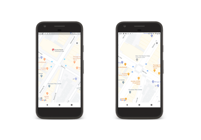
The updated city maps will not be making an appearance on Maps immediately, but Google says that the feature will be available for New York, London, and San Francisco in the coming months. Google also added that once the detailed city maps are made available to the three cities, the company will start rolling out this feature for other cities, including those out of the U.S.
The updated natural features, on the other hand, will benefit users all over the globe. Google's satellite imagery used a color-mapping technique particularly for regions that are arid, mountainous, icy, or forested. For example, a dense forest will appear in a shade of dark green, while patchier shrubs will be distinguishable in a lighter shade of green. Similarly, it will be easier to differentiate between beaches and greenery, notice the beginning and ending of a desert, see how much land is covered by an ice cap, and so on.
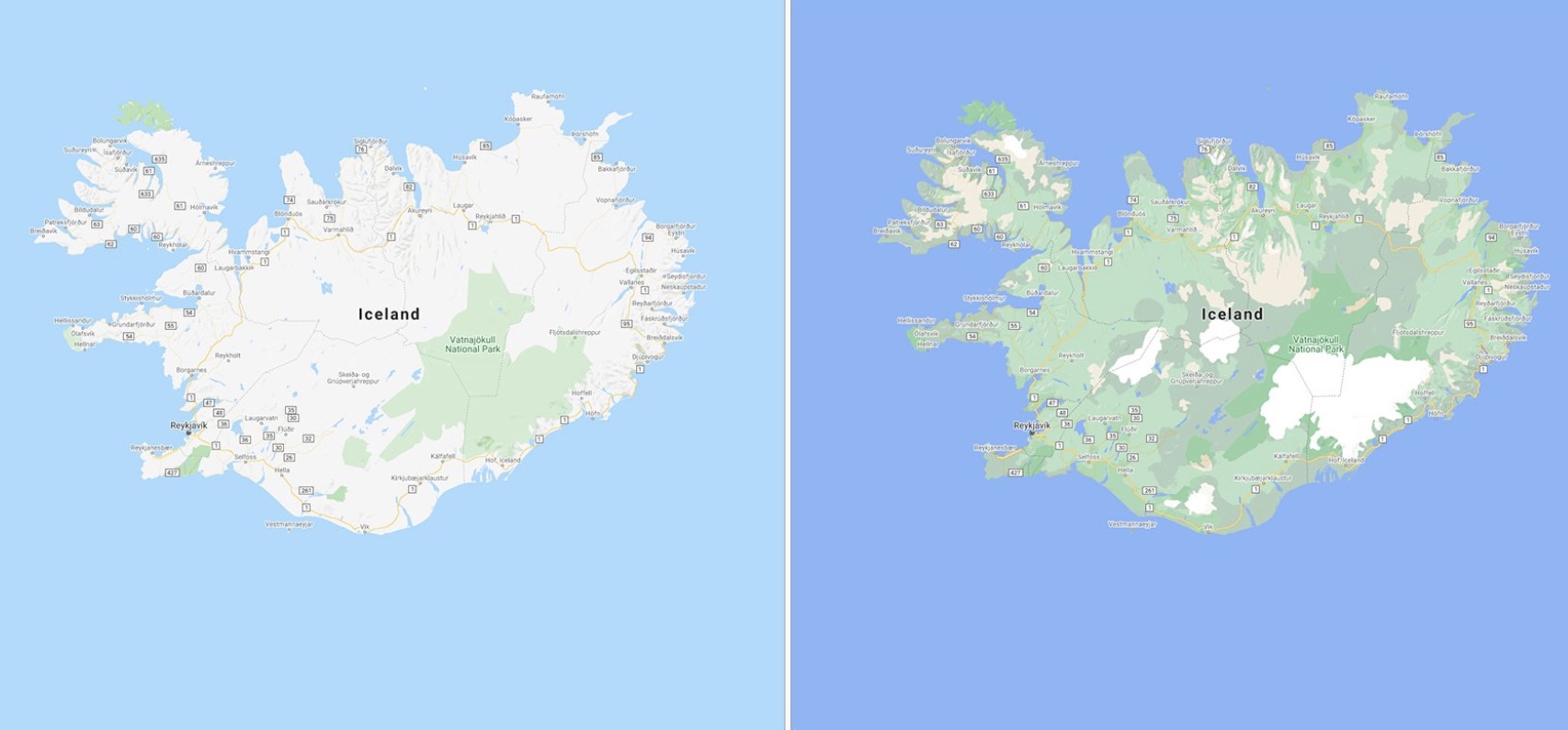
The updated natural features will be viewed by users in all 220 countries and regions that are supported by Google Maps.

Meanwhile, Apple's Maps app has become a potential rival for Google Maps ever since it has received significant updates. Apple Maps exhibit noticeable features like a higher-resolution 3D feature, the Look Around feature, and the most recent feature that enables users to raise their smartphone to scan the skyline and refine their location. Apple Maps is also challenging Google Maps with its explore and discovery features. This has encouraged Google to add improvements to Maps in order to keep moving ahead in the race of Maps.
The latest Google Maps features are said to be rolling out for iOS, Android, and desktop as soon as the next few months.
